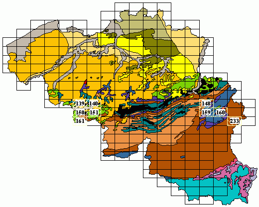
MGI : Military Geographic Institute
(*) – The maps of the Mons basin also show the presence of the mine shafts, active and abandoned quarries, boreholes and outcrops.
(**) – The maps of the Stavelot Massif indicate the boreholes, fossiliferous sites, active and abandonned quarries, carbonic-gas sources (called “pouhons” in French), galleries and outcrops.
(***) – The geological map 233 shows the outcrops, active and abandoned quarries, fossiliferous sites (also with plants) and ore deposits.
(+) – The map n° 233 has no explanatory booklet !
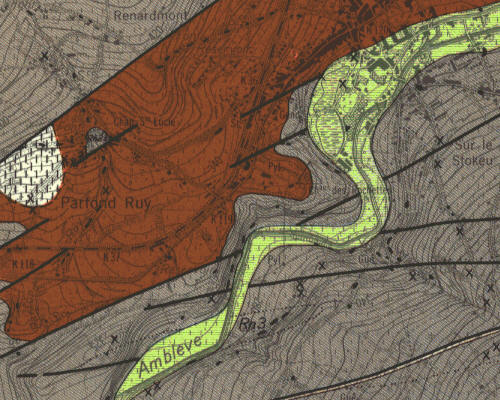
The following image shows the Stavelot city (upper right corner) that lies on the northern part on Permian conglomerate (brown) and on black slates (grey) of the Revin Group (named previously Revinian) in the southern part.
The “Revinian” is partly covered by the Quaternary alluvial deposits (green) of the “Amblève” river. The dark lines correspond to faults.
Prices
The maps are avalaible on:
– paper format, individually at the price of 14,00 EUR/map and explanatory booklet included + the shipping costs
– digital form ![]() , the rasters are georeferenced for the GIS MapInfo and ArcView. The explanatory booklets are avalaible in PDF (text files) and in JPG format (image files). All the geological maps with the explanatory booklets are delivered (1) either on DVD at the price of 45,00 EUR/9 maps with the explanatory booklets + the shipping costs (2) either in a digital zip file using a secured transfer file server at the price of 25.00 EUR.
, the rasters are georeferenced for the GIS MapInfo and ArcView. The explanatory booklets are avalaible in PDF (text files) and in JPG format (image files). All the geological maps with the explanatory booklets are delivered (1) either on DVD at the price of 45,00 EUR/9 maps with the explanatory booklets + the shipping costs (2) either in a digital zip file using a secured transfer file server at the price of 25.00 EUR.
To Order:
| This product is available for sale at the GSB. For ordering, please contact – gsb@naturalsciences.be |
